
Distances Between Ports
An exercise in using regular expressions and making a simple dataset.
TL;DR: Find the repo on Github.
I recently got involved in a project which had me trying to estimate the CO2 emissions for goods shipped worldwide. Since so many goods are moved around on giant container ships, I was looking for a way to estimate the distance between large ports. A quick search later, I came across Distances Between Ports (Pub. 151).
The document is a long list of all the major ports, with distances to other nearby ports and Junction Points. The Junction Points help consolidate routes, making it practical to publish this in print format, coming in at 100-odd pages.
Unfortunately, this PDF format is far from ideal if you want to use a script to calculate anything.
Fortunately, with a quick copy–paste into a text editor, it’s possible to get all the text out, more or less ready for some Regular Expression parsing.
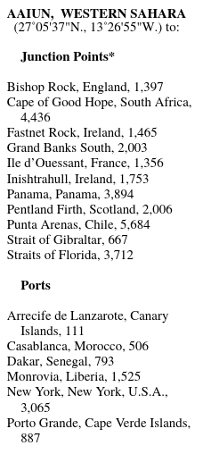
With a quick python script we can change this:
into this:
"Aaiun, Western Sahara": {
  "destinations": {
    "Arrecife de Lanzarote, Canary Islands": 111.0,
    "Casablanca, Morocco": 506.0,
    "Dakar, Senegal": 793.0,
    "Monrovia, Liberia": 1525.0,
    "New York, New York, U.S.A.": 3065.0,
    "Porto Grande, Cape Verde Islands": 887.0
  },
  "junctions": {
    "Bishop Rock, England": 1397.0,
    "Cape of Good Hope, South Africa": 4436.0,
    "Fastnet Rock, Ireland": 1465.0,
    "Grand Banks South": 2003.0,
    "Ile d’Ouessant, France": 1356.0,
    "Inishtrahull, Ireland": 1753.0,
    "Panama, Panama": 3894.0,
    "Pentland Firth, Scotland": 2006.0,
    "Punta Arenas, Chile": 5684.0,
    "Strait of Gibraltar": 667.0,
    "Straits of Florida": 3712.0
  },
  "location": "27°05'37\"N., 13°26'55\"W."
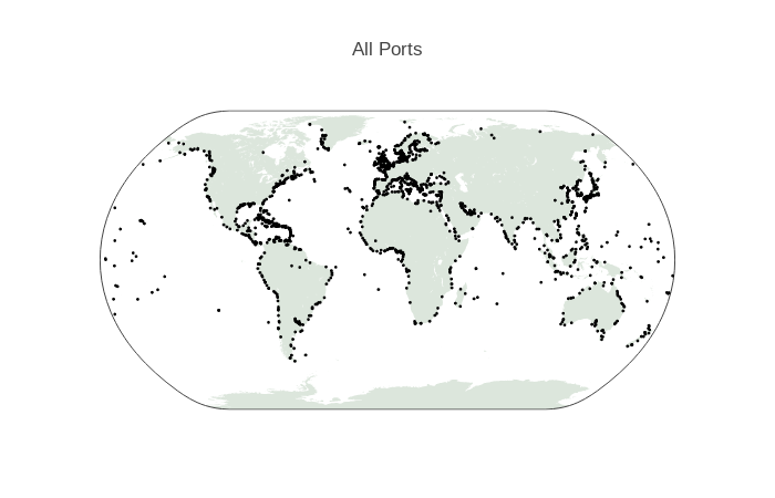
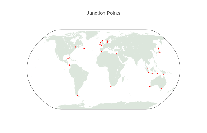
Making it easy to plot all of the ports on a map
Likewise, and even easier, we can change this:
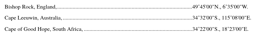
into this
{
  "Bishop Rock, England": "49°45'00\"N., 6°35'00\"W.",
  "Cape Leeuwin, Australia": "34°32'00\"S., 115°08'00\"E.",
  "Cape Of Good Hope, South Africa": "34°22'00\"S., 18°23'00\"E."
}
The extracted data in JSON format, together with the parser script is available on Github.
Updates
Excited to see Martyn Verhaegen implemented an A* pathfinding algorithm on the data.